Hiking in the Azores Islands: Best Hiking Trails
 5 December 2022 | Guides, Portugal |
  45 mins

Pinterest
Facebook
Reddit
Twitter
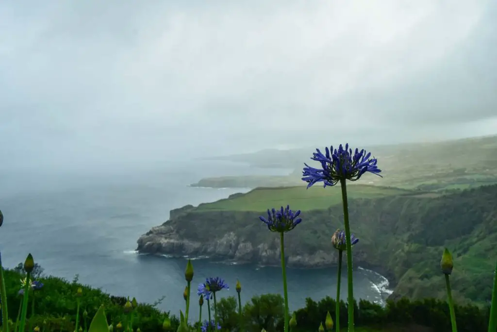
Hiking in Azores has become one of the best ways to explore these enchanting tropical islands in the middle of the Atlantic Ocean. It is no surprise that most of their visitors choose to step on the hiking trails. There are more than 80 official hiking trails in the Azores that offer stunning views of the Atlantic Ocean. Or the serenity of the almost untouched Azores islands. Or, you get to pass by some of the most tranquil forests…
I will not spoil this for you no more, so without further ado I urge you to read on this Azores hiking guide:
Navigate to:
Hiking The Azores
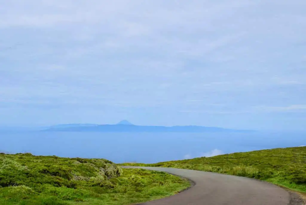
Azores islands hiking can be a rather pleasant experience. Beautiful views, rather mild tropical climate, happy people all around and a much appreciated serenity all around.
The hiking trails in the Azores are quite easy to hike… with a couple of exceptions. Each trail has different lengths, landscapes, difficulty level or altitudes, but you can choose which trail to hike based on your preferences. Anyway, to help you with this choice, I suggest you follow through this detailed Azores hiking blog …

![]()
Official Azores hiking trails
When it comes to hiking the Azores islands, it is always good to stick to the official hiking trails. “What does it mean?” you ask. Well, the official hiking trails in the Azores are the ones that are approved, maintained, and signed by the Azores Tourism Board. Their only purpose is to guarantee the safety and reassurance of the hikers in the Azores islands.
The Azores Tourism Board is a very useful website, which can give you lots of information on the hiking trails in the Azores. There you can find lots of leaflets with step-by-step explanations & detailed maps to easily navigate through the islands.
7 Days Itinerary for Sao Miguel
Learn the ins and outs for visiting the Azores Greenest islands…
Read More…
Off the beaten path hiking trails
You can easily get off from the official hiking trails in the Azores. That’s simply because, even the off beaten paths look like right way to go. However, these paths are not marked or maintained by the Azores Tourism Board, which makes them not officially approved or safe.
However, even if you happen to slip on one of these paths, do not worry. You can always easily navigate yourself back to the proper ones. Personally, I use MAPS.ME, which a map application you can use offline and in the middle of nowhere. It has proven itself useful and has gotten me out many times from trouble.
Hiking Trails in The Azores
So, you might be wondering now which is the best island for hiking in the Azores islands or which are the best hiking trails in Azores. Well, the Azores Islands are a hiking heaven, thus it might be quite hard to answer this question, that is why you have this Azores hiking itinerary at hand…
The Azores islands have so many hiking trails, so it can be quite difficult to decide where to go. Nevertheless, it is good to point out that the São Miguel island has 22 open hiking trails with stunning views to choose from. This makes it one of the best Azores island for hiking in that aspect. However, Pico has 13 hiking trails and one of them leads you to the highest peak in Portugal, which is also tempting. Last but not least, there are also 5 Grand routes on 5 of the Azores islands to hike on.
Thus, having this information at hand – it can be quite difficult to decide where to start, but you can always start somewhere. Check below for best hikes in Azores…
São Miguel Hiking Trails
São Miguel island is probably the best island in the Azores archipelago for hiking. Most of the hiking trails in São Miguel are leading to beautiful landscapes of the ocean or the whole island. Some of them are going through thick laurel forests. Others are leading to hidden waterfalls and ancient ruins. Having this in mind, Sao Miguel hiking can never be boring or dull…
As promised, I’m sharing São Miguel best hikes! And some of the best hiking trails in Azores islands!
SAO MIGUEL HIKING TRAILS MAP
Sao MIguel Island Hotels
Find out the best hotels to stay in Sao Miguel Island!
BOOK NOW
Vista do Rei – Sete Cidades Hiking Trail
Vista do Rei to Sete Cidades is for sure a hiking trail you should try. To be quite honest, it is one of the best hiking trails in Azores and is a must see!
It goes through the islands highlights and starts at Vista do Rei viewpoint, which overlooks both of the Sete Cidates lakes. Lagoa Verde and Lagoa Azul are the two most photographed lakes on the islands. They are laying in huge volcano craters that are no longer active and are in close proximity to the ocean. Thus, the view over the lakes is quite stunning.
Then, going forward, slowly but steadily, following the signs you will go down the way to the village of Sete Cidates. There you can go closer by the lakes or visit the nearby church – the Igreja de São Nikolau.
Vista do Rei – Sete Cidades Hike Overview
📍 Starting Point: Vista do Rei Viewpoint
🏞️ End Point: Sete Cidade village
🗺️ Type of hiking trail: Linear
🥾 Distance: 8 km
⌚ Time: 2 hours
🧗 Difficulty: Easy
Mata do Canário – Sete Cidades Hiking Trail
Similar to the Sete Cidades hike, Mata do Canario goes along the Sete Cidades lakes, but from the northern side of the island. It starts from the Canário lake where you can stop by for a bit of peace and quiet, and then start your trip up the slope.
To go to Sete Cidades, you need to follow the dirt road from Canário lake until you hit the road. During this hike, you will see an ancient aqueduct and also the Pico da Cruz viewpoint, which gives a nice look over the Santiago lake. Then, follow the sign that says Sete Cidades to climb a couple of more peaks around the lakes and go down the village of Sete Cidades.
Mata do Canário – Sete Cidades
📍 Starting Point: Canário lake
🏞️ End Point: Sete Cidades village
🗺️ Type of hiking trail: Linear
🥾 Distance: 12 km
⌚ Time: 3 hours
🧗 Difficulty: Medium
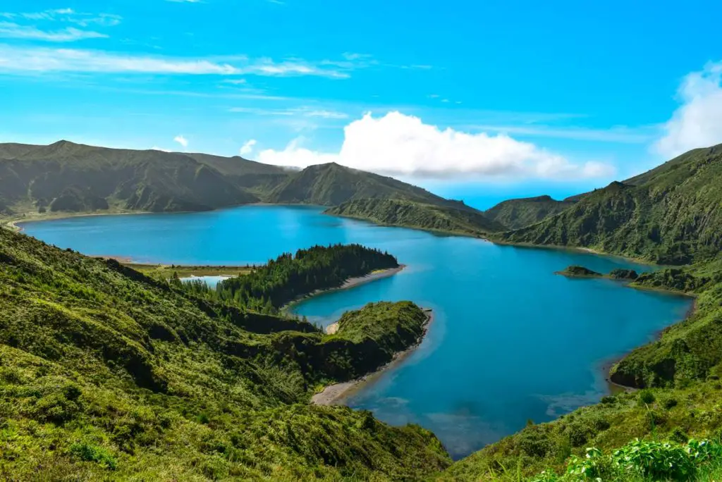
Praia – Lagoa do Fogo Hiking Trail
Lagoa do Fogo is the second best spot on the island of Sao Miguel after the lakes of Sete Cidades. This mystical lake, surrounded by laurel vegetation brings back some Jurassic Park vibes all the way to its beach.
Although, this hiking trail can start from almost anywhere, its official starting point is a dirt road close to farming lands and pastures. Then, a steep climbing awaits until you reach the Ribeira da Praia – a spacious meadow with slopes on both side and a small river in between. Finally, following the pathway you will reach the banks of the Lagoa do Fogo.
For those who do not want to walk a lot, it is best to arrive very early in the morning at Pico da Barrosa. From there you can observe the lake from above, as well as the seagulls that are settled in these lands. To reach the beach, you just need to walk down to it. However, you can walk around the pathways and even spot the Vila Franca do Campo islet and many other parts of the island.
Praia – Lagoa do Fogo Hiking Trail
📍 Starting Point: Pico
🏞️ End Point: Lagoa do Fogo
🗺️ Type of hiking trail: Circular
🥾 Distance: 11 km
⌚ Time: 4 hours
🧗 Difficulty: Medium
Sanguinho Hiking Trail
Sanguinho hiking trail or the Salto do Prego hike, as it is known, is among the best Sao Miguel hikes. It provides some of the most tranquil pathways and is going entirely through a forest leading to the Salto do Prego waterfall.
This hiking trail starts at the bus stop of the Faial da Terra city. It follows an old pathway going through thick laurel vegetation and some ancient ruins. Along the way there are some steep climbs, which are not necessarily hard to climb. However, be very careful of the road ahead, as it might be very slippery.
Eventually, you end up at a crossroad where you can choose to go to Salto do Prego waterfall or Cagarrão waterfall. Or you can do both! Your choice!
📍 Starting Point: Faial da Terra
🏞️ End Point:Salto do Prego/ Cagarrão
🗺️ Type of hiking trail: Circular
🥾 Distance: 5 km
⌚ Time: 2 hours
🧗 Difficulty: Medium
Lagoa das Furnas Hiking Trail
Тhis circular hiking trail around the lake of Furnas is a quite mystical walk away from the crowds. It attracts many hot spring enthusiast and people that want to dive in the culture of the Azores islands.
You can start your journey at the crossroad of rua Largo das Três Bicas and slowly go down the street. The real trail starts once you reach the paved road that goes around the crater lake. Along this hiking trail you will cross the Chapel of Nossa Senhora das Vitórias. A gothic construction, built in the 19th century. It is architecturally rich religious temple devoted to Our Lady of the Victories. According to the story, a rich farmer issued the building of this church, as his beloved wife was sick of an incurable illness. Nowadays, the chapel is a memorial of the great fights we deal with on a daily.
Going forward, you will cross the garden Mata Jardim José do Canto and by the house Casa dos
Barcos. Then, follows the Furnas Monitoring & Research Centre along with some leisure places where you can have some rest or even picnic. Eventually, you will end up at the so called Caldeiras, which is literally translated as kettles or boilers. This is the place where the famous traditional Cozido à Portuguesa is made using the heat of the Furnas volcano.
📍 Starting Point: Largo das Três Bicas
🏞️ End Point: Furnas city
🗺️ Type of hiking trail: Circular
🥾 Distance: 10 km
⌚ Time: 3 hours
🧗 Difficulty: Medium
Chá Gorreana Hiking Trail
I bet you have not hiked around a tea plantation before! Well, now’s your probably once in a lifetime chance to do so! This circular hiking trail is a bit unusual for the avid hiker, but one to remember!
It starts at the Chá Gorreana tea factory, which has a quite rich history. The tea plantation was built in 1883 and is the oldest tea plantation in whole Europe. Nowadays, it is in fact the only tea plantation that produces fine green and black tea in Europe. Its history goes back to the 1750 when the Camellia sinensis was brought to the São Miguel island from the East. The people of the island, along with Lau-a-Pan, a Chinese tea producer planted the first tea plants.
Now, the hiking trail of Chá Gorreana goes around the plantation and if you simply follow the signs, you will have a very pleasant experience. On this hiking trail, you are guaranteed to witness breathtaking views of the ocean, as well as of the beautiful nature of the green island.
📍 Starting Point: Chá Gorreana Tea Factory
🏞️ End Point:Chá Gorreana Tea Factory
🗺️ Type of hiking trail: Circular
🥾 Distance: 4 km
⌚ Time: 2 hours
🧗 Difficulty: Easy
Moinhos da Ribeira Funda Hiking Trail
Moinhos da Ribeira Funda hiking trail is the perfect way to find more about the culture and history of the island. The hiking trail starts at Chapel of Nossa Senhora da Aflição and goes along a rich cedar forest in which you can witness many bird species.
Slowly, but steadily, you will reach the Moinhos do Crim, which is home to some old watermills and ancient levadas dating back to the 15th century. The levadas are a complex irrigation system that was used by the settlers of the Azores islands that were bringing water to the villages. They were of utmost importance for the survival of the early inhabitants. Nowadays, they can be seen everywhere around the Azores islands and Madeira.
Then, following the signs you will get to the Cascatas da Ribeira Funda and finally the Vista da costa Noroeste. Keep on walking until you reach the Chapel of Nossa Senhora da Aflição where your journey ends.
Moinhos da Ribeira Funda Hiking Trail
📍 Starting Point: Chapel of Nossa Senhora da Aflição
🏞️ End Point: Chapel of Nossa Senhora da Aflição
🗺️ Type of hiking trail: Circular
🥾 Distance: 4 km
⌚ Time: 2 hours
🧗 Difficulty: Medium
Caldeiras da Ribeira Grande – Salto do Cabrito Hiking Trail
Caldeiras of Ribeira Grande are well-known hot springs on the island of Sao Miguel. And this is where the trail to Salto do Cabrito waterfall marks its beginning.
Along your way to the Salto do Cabrito waterfall you will go through some thick tropical vegetation and a few power plants of the island. Then, close by you will hear the waterfall’s roaming and if you follow the signs for a bit you will even see it. The path goes through a nice gorge where you can find some peace and quiet. Once you reach Salto do Cabrito you can either follow the way back or continue on by following the signs to reach the Caldeiras of Ribeira Grande.
Caldeiras da Ribeira Grande – Salto do Cabrito Hiking Trail
📍 Starting Point: Caldeiras of Ribeira Grande
🏞️ End Point:Caldeiras of Ribeira Grande
🗺️ Type of hiking trail: Circular
🥾 Distance: 9 km
⌚ Time: 3 hours
🧗 Difficulty: Medium
Padrão das Alminhas – Salto da Farinha Hiking Trail
This linear pathway connects two of the northern villages on the island of Sao Miguel – Achadinha and Salga. It’s starting point is the Historical Standard of Alminhas monument. A fun fact is that on this place, the liberal forces from Terceira island landed here during the Portuguese Civil War. Hence, the monument.
Following the pathway, you will find the Vista para a Cascata, which is the first waterfall of many to come. Then, you will descend a bit ending up in the Poço Azul, which is a small secluded waterfall cascade. After that, you will cross the Ponte de Nosso Senhor bridge and end up at the Salto da Farinha waterfall. Close by, you will reach the Miradouro do Salto do Farinha where this hiking trail ends.
Padrão das Alminhas – Salto da Farinha Hiking Trail
📍 Starting Point: Historical Standard of Alminhas monument
🏞️ End Point:Miradouro do Salto do Farinha
🗺️ Type of hiking trail: Linear
🥾 Distance: 5 km
⌚ Time: 2 hours
🧗 Difficulty: Medium
Serra Devassa Hiking Trail
If you are into walking around volcanic cones, then the Serra Devassa hiking trail is for you! It is just 30 minutes away from Ponta Delgada, the capital of Sao Miguel Island, which makes it an easy reach. On top of that, it goes through one of the Protected areas on the island.
The hike starts at the Mata do Canário, but instead of following the trail to the Sete Cidades lakes, you go the opposite way and up the hill. Along the way you will find the Pau Pique lake and the ruins of the Muro das Nove Janelas aqueduct. This aqueduct had a huge importance for the supply of Ponta Delaga back in the days.
Then, follows the highest point of Pico das Éguas from where you can see the Éguas and Rasa lakes. Finally, you will reach the Empadadas lake and following the pathway you will go back to the starting point.
It is good to point out that the best time to visit this area is when there is good visibility.
📍 Starting Point: Forest Park of Mata do Canário
🏞️ End Point: Forest Park of Mata do Canário
🗺️ Type of hiking trail: Circular
🥾 Distance: 5 km
⌚ Time: 2 hours
🧗 Difficulty: Medium
Pico das Camarinhas – Ponta da Ferraria Hiking Trail
If you want to dip into some hot ocean water, then you should do the hike to Ponta da Ferraria! This chill hiking trail starts at the viewpoint of Ilha Sabrina. Then, following the way, you will pass by Pico das Camarinhas where you will witness some of the most stunning views on the island of Sao Miguel.
After that, the pathway goes straight down to the and there you will be able to see the Vista para a arriba fossil and Arcos litorais. These lava formations have been formed not long ago in 1811. Fun fact is that during this volcanic eruption a new island called Sabrina was formed. However, it submerged as quickly as it appeared and today it is almost gone.
Eventually, you will end up at the Piscina Termal Natural where you can dip in and enjoy the 30ºC water. The water can sometimes be too hot, due to the fact that a hot spring is directly flowing into the ocean. Hence, it is good to be careful before dipping in…
Pico das Camarinhas – Ponta da Ferraria Hiking Trail
📍 Starting Point: Viewpoint of Ilha Sabrina
🏞️ End Point: Piscina Termal Natural
🗺️ Type of hiking trail: Linear
🥾 Distance: 5 km
⌚ Time: 3 hours
🧗 Difficulty: Easy
Pico da Vara Hiking Trail
This challenging Pico da Vara hike goes through the islands ridges and requires some caution. You can start at the Forest Guard House of the Reserve of Atalhada. Walking up the pathway you will have a good view over the villages of Santo António Nordestinho, Algarvia and Povoação.
Eventually, you will reach the peak of Vara from where you will get an even better view over the island. Some of the views you will enjoy are over the Povoação crater, Planalto dos Graminhais, Furnas Volcano and its lake and Fogo and Sete Cidades volcanic massifs.
📍 Starting Point: Forest Guard House of the Reserve of Atalhada
🏞️ End Point: Pico da Vara
🗺️ Type of hiking trail: Circular
🥾 Distance: 7 km
⌚ Time: 3 hours
🧗 Difficulty: Hard
Rota da Água – Janela do Inferno Hiking Trail
If you are in for a mystical and tropical adventure, you chose the right hiking trail! This hiking trail in the south part of the island of Sao Miguel is an easy one, and quite enjoyable.
The Janela do Inferno hike starts at Casa da Água, where the trail point is. Then, going down the road you will step on the dirt road where your adventure will begin. The first sight you will encounter is the Janela do Inferno, which is known as “Hell Window” and is a cave like formation. Then, following the sings you will encounter an ancient aqueduct, which is a quite common sight for the Azores islands. Eventually, after passing through a couple of tunnels you will end up at the starting point of the hike.
Rota da Água – Janela do Inferno Hiking Trail
📍 Starting Point: Casa da Água – Trail Point
🏞️ End Point: Casa da Água – Trail Point
🗺️ Type of hiking trail: Circular
🥾 Distance: 8 km
⌚ Time: 3 hours
🧗 Difficulty: Easy
Terceira Hiking Trails
The so-called “Third Island” of the Azores archipelago is known as the culture stop of the islands. With its capital Angra do Heroismo, it attracts lots of culture and history lovers who want to dive deep into the story of the islands.
Nevertheless, that does not mean that there are no hiking trails in Terceira. In fact, the island offers 9 hiking trails and 1 Great Route to explore, which are among the best hikes in the Azores islands. Unlike the island of Sao Miguel, Terceira is a bit easier to hike, as its hills are not that steep. Thus, I would say that, hiking in Terceira feels more like walking. Still, it really depends on how physically prepared you are.
Below, I’m sharing some of the best hikes in Terceira island…
TERCEIRA HIKING TRAILS MAP
Terceira Island Hotels
Find out the homiest hotels to stay in Terceira Island!
BOOK NOW
Mistérios Negros Hiking Trail
This challenging hiking trail goes through Terceira’s Natural Reserve and its Natural park – Natural Reserve of Serra de Santa Bárbara and Mistérios Negros of Natural Park of Terceira. It also goes through a cave and a couple of peaks on the island.
To start the hike, you can go to Lagoa do Negro, which is in close proximity to Gruta do Natal, one of Terceira’s caves. Going forward, you’ll see 3 small lakes known as Lagoinhas do Vale Funda. Out of the three lakes, only 1 of them keeps its water during the whole year. Thus, if you see all of them – consider yourself lucky.
Last but not least, just before finishing your exploration, you’ll have the chance to see the Pico da Cancela, Pico Gordo, the central massif of the and Pico Gaspar. If you have some energy left, you can try climbing Pico do Gaspar, but with great caution. It is a still a volcano cone…
📍 Starting Point: Lagoa do Negro
🏞️ End Point: Lagoa do Negro
🗺️ Type of hiking trail: Circular
🥾 Distance: 5 km
⌚ Time: 3 hours
🧗 Difficulty: Hard
Serreta Hiking Trail
Serreta hiking trail is one of the trails that goes around the Natural Park of Terceira and the natural
reserve of Serra de Santa Bárbara and Mistérios Negros. There you can observe lots of Azorean endemic vegetation species like the Juniper, Heather and Laurustinus.
The hiking trail starts at the crossroad of Canada da Fonte and follows the dirt road ahead. It goes through thick vegetation until it reached the Lagoinha, a small lake inside of a long gone volcano caldera. Then, continue on the road following the signs until you reach the Ribeira do Além. That’s an open area which goes through domes and a vast valley, also known as Biscoito da Fajã.
Finally, you’ll pass through Pico do Negrão where you can observe the whole area and keep on following the pathway until you reach Canada da Fonte.
📍 Starting Point: Canada da Fonte
🏞️ End Point: Canada da Fonte
🗺️ Type of hiking trail: Circular
🥾 Distance: 7 km
⌚ Time: 3 hours
🧗 Difficulty: Medium
Algar do Carvão – Furnas do Enxofre Hiking Trail
This Terceira hiking trail connects two very important natural monuments – Algar do Carvão and Furnas do Enxofre. The hike starts at the parking lot for Algar do Carvão, there you’ll see the sign for the trail. Follow the road until you reach the Terceira forest surrounded by the hills of the island.
Right after the Laurisilva forest, you’ll find the panoramic views of Pico da Salsa, Pico Tamujo, and Sanguinhal, a muddy meadow. Shortly after Sanguinhal, you’ll find the sign that leads to Furnas do Enxofre. You can check out the area and the geysers set around the area, but be careful and stick to the wooden pathway. Then, go back to the main road and continue to Pico do Alpanaque and Caldeira do Guilherme Moniz from where you will have a view over Serra de Santa Bárbara massif and the islands of São Jorge and Pico. Eventually, you’ll reach Pico do Sanguinha from where you can descend back to Algar do Carvão and check out the cave, which is a must-see!
Algar do Carvão – Furnas do Enxofre Hiking Trail
📍 Starting Point: Algar do Carvão
🏞️ End Point: Algar do Carvão
🗺️ Type of hiking trail: Circular
🥾 Distance: 6 km
⌚ Time: 3 hours
🧗 Difficulty: Medium
Monte Brasil Hiking Trail
Monte Brasil is Terceira’s beautiful natural park formed long time ago by an ancient extinct volcano. It’s in close proximity to the island’s capital Angra do Heroísmo, classified as World Heritage by UNESCO. Within this area you’ll find the 16th century fortress of São João Baptista, an animal shelter and some deers running around.
Begin this Monte Brasil hike at Relvão and go up the road until you reach Pico do Facho and the Signal station. From there you’ll be able to observe the bay of Angra. Then, you can explore the Terceira forest in Monte Brasil where you’ll find a couple of animal shelters. Eventually, you can follow the pathway back to Pico das Cruzinhas and to Relvão, which is the last stop.
📍 Starting Point: Free Parking Monte Brasil/Relvão
🏞️ End Point: Free Parking Monte Brasil/Relvão
🗺️ Type of hiking trail: Circular
🥾 Distance: 7 km
⌚ Time: 3 hours
🧗 Difficulty: Medium
Sao Jorge Hiking Trails
This elongated piece of land in the middle of the Atlantic Ocean is often overlooked by tourists. Although, it has a lot to offer. Covered in lush endemic vegetation, it gives you the ultimate experience when it comes to hiking. (I’m not quite sure why people don’t put it on their list for “best island in azores for hiking”?)
São Jorge island has 6 hiking trails and 1 Grand route that follows the high steep cliffs all over the island. Dare to visit Sao Jorge?! You should definitely put it on your list, as it does not only offer great hiking trails, but also amazing natural swimming pools and cuisine!
SAO JORGE HIKING TRAILS MAP
Sao Jorge Island Hotels
Find out the coolest hotels to stay in Sao Jorge Island!
BOOK NOW
Pico do Pedro – Pico da Esperança – Fajã do Ouvidor
If you want to go over most of the peaks of Sao Jorge, this is the perfect route! It starts at Pico do Pedro and goes over the highest point of the island, which is Pico da Esperança. From this point you can observe this mesmerizing Azorean island and the vastness of the Atlantic Ocean.
During your hike, you will go through the central volcanic range of Sao Jorge island, which stands at 800 – 1000 meters high. Following the pathway, you will be able to visit some of the island’s protected areas around Pico da Esperança and the Central Vulcanic range.
Starting at Pico do Pedro, you can follow the path to Pico da Esperança. There you will see some of the highest peaks of Sao Jorge – Carvão, Junça, Verde, Montoso and Morro Pelado. Once you get to Pico da Esperança you can go around the lake that is in the crater and get some rest.
Then, follow the path to Pico do Areiro and pass by Pico Pinheiro, until you reach the crossroad for F Faja do Ouvidor. Along the way you can stop by the Miradouro da Fajã do Ouvidor, which overlooks the fishing village from above. Keep your feet on the trail and explore the natural pools of Norte Grande parish.
! Make sure to hike on this trail when the weather allows it.
Pico do Pedro – Pico da Esperança – Fajã do Ouvidor
📍 Starting Point: Pico do Pedro
🏞️ End Point: Faja do Ouvidor
🗺️ Type of hiking trail: Linear
🥾 Distance: 17 km
⌚ Time: 4 hours
🧗 Difficulty: Medium
Serra do Topo – Caldeira do Santo Cristo – Fajã dos Cubres
This pretty straight forward route is one of the top hikes in São Jorge island. The Faja dos Cubres hike starts at the Park of Serra do Topo where one can observe many endemic flora species, as well as some birds.
Following the signs, you will reach the road for Caldeira de Cima. By crossing the bridge of Tia Júlia you will get to Cascata Pequena, which is a beautiful waterfall in the middle of the island. Following the descending hiking trail you will find the Miradouro da Caldeira de Santo Cristo. From there you can observe the whole Caldeira Santo Cristo area and Caldeira de Santo Cristo Lake, which is a protected landscape. This lake is known as a home to lots of clams and many bird species that come to nest in the area.
Keep on walking down the hiking trail and pass by Fajã do Belo, which was evicted in the 1980 due to an earthquake. Walking down the road you will see Fajã dos Cubres, which is your final stop and the church of Nossa Senhora de Lourdes.
Serra do Topo – Caldeira do Santo Cristo – Fajã dos Cubres
📍 Starting Point: Park of Serra do Topo
🏞️ End Point: Fajã dos Cubres
🗺️ Type of hiking trail: Linear
🥾 Distance: 10 km
⌚ Time: 3 hours
🧗 Difficulty: Medium
Fajã de Além Hiking Trail
If you are into visiting one of the most remote area on the island of Sao Jorge, then you should definitely follow the hike to Fajã de Além Hiking Trail.
This hiking trail starts at the Chapel of Santo António and follows a descending pathway. While walking down the dirt road you can observe the Fajãs de Além, Ouvido and Ribeira da Areia from above. If the weather is good and there is a good visibility, you will be able to see the islands of Graciosa and Terceira.
Keep on going down the hiking trail where you will find some small rural houses, along with some wine cellars and a watermill. Interestingly enough is that the locals still live by the old ways and nothing has really changed for them.
Once you are at Fajã d’Além, you can start climbing back, so you can reach the end point. This will probably be the toughest part of the trail. However, it might be the most rewarding, as some mesmerizing views will be revealed upon your ascending.
📍 Starting Point: Chapel of Santo António
🏞️ End Point: Chapel of Santo António
🗺️ Type of hiking trail: Circular
🥾 Distance: 5 km
⌚ Time: 3 hours
🧗 Difficulty: Hard
Pico Hiking Trails
The island of Pico is part of the central group of islands of the Azores archipelago. It is named after the notable Mount Pico that stands some 2,351 meters above sea level. Having said that, you should already have Pico island on your list!
Pico island has 13 hiking trails and 1 notable hiking trail that takes you to the top of the island. Having said that, you should already know that you might experience some of the best hiking in Azores islands! And, if you are lucky enough and the weather is with you, you’ll get to see all of the islands in this area.
PICO HIKING TRAILS MAP
Pico Island Hotels
Find out the extravagant hotels to stay in Pico Island!
BOOK NOW
Caminho das Lagoas Hiking Trail
If you want to see the beautiful lakes of Pico island, you will have to get on this hiking trail. It starts at the main road (EN 2) near the Forest Services house. It goes down the way where it reaches the first lake – Caiado, which is a very beautiful lake from where you can see both the ocean and Pico peak. Along the way you will encounter the rest of the lakes – Lagoa Seca, Lagoas do Peixinho and Lagoa do Paúl.
Then, you will reach Lagoa da Rosada, which is sitting near one of the highest hills on this trail. From there you can see the islands of Terceira and Sao Jorge. Keep on walking to Lagoas do Peixinho and José Inácio and then follow the road to Ribeirinha.
Caminho das Lagoas Hiking Trail
📍 Starting Point: EN 2
🏞️ End Point: Ribeirinha
🗺️ Type of hiking trail: Linear
🥾 Distance: 23 km
⌚ Time: 7 hours
🧗 Difficulty: Easy
Canadas da Ribeirinha Hiking Trail
This hiking trail is all about exploring the endemic flora of the island, visiting the wine cellars and enjoying the views. It starts at the road of Terra Alta and goes down to the village of Ribeirinha. It passes through the Miradouro da Terra Alta, Miradouro do Alto dos Cedros and Caminho da Atalhada where you can enjoy some of the best views of the Sao Jorge island.
Going down the road, follow the pathway after Ribeirinha to Canada do Mar, where you can visit the prominent wine cellars of Pico. Once ready, follow the Caminho litoral to Calhau, which is the last stop and enjoy the views of Ponta Gorda and Ponta das Trombetas.
Canadas da Ribeirinha Hiking Trail
📍 Starting Point: Terra Alta
🏞️ End Point: Calhau
🗺️ Type of hiking trail: Linear
🥾 Distance: 9 km
⌚ Time: 4 hours
🧗 Difficulty: Easy
Vinhas da Criação Velha Hiking Trail
Having the full wine experience in Pico island is absolutely possible! You can have all that by following the Vinhas da Criação Velha hiking trail that connects the villages of Madalena and Candelária. This area of Pico island is classified as a World Heritage Site of UNESCO since 2004. It is the most notorious vineyard area of Pico island where the culture and process of wine production has been preserved over the ages.
The hiking trail starts at Porto do Calhau and goes along the way to the village of Madalena. The hiking trail is pretty straight forward and goes around the vineyards of Pico. Along the way you can stop by the Vista para a ilha do Faial, where you can enjoy a close by view of Faial island.
Right after the Laja das Rosas natural pools are the vineyards of Pico island. In this area you will be able to witness the way wine is made in the Azores and the old ways used for its produce. Right in the vineyard area there are lots of wine cellars you can check, as well as the famous Moinho do Frade windmill. Once ready, follow the main road until you reach the city of Madalena.
Vinhas da Criação Velha Hiking Trail
📍 Starting Point: Porto do Calhau
🏞️ End Point: Madalena
🗺️ Type of hiking trail: Linear
🥾 Distance: 7 km
⌚ Time: 2 hours
🧗 Difficulty: Easy
Mount Pico Hiking Trail
Climbing Mount Pico is probably the highlight of Pico island and one of the best hiking trails in Azores. However, climbing to the top of the Azores islands is no joke and asks for serious preparation. After all, you will be climbing to 2351 metres of altitude, which takes around 4 hours of climbing.
Hiking to the top of Pico island is a moment to remember for sure, and it is best to do it the right way by booking a guide to take you there. This is also the safest option and a good way to avoid any issues on the way.
Along the way, you will go up the mountain top and reach Piquino, which is another peak before reaching Pico. Usually, people stop there for some rest before going up to Pico. From there, you have to go up to the top of the mountain but at a steady pace. Follow the markers and do not go on paths that are not signed.
After you get to the top, and the weather allows it, you will be able to see the islands of Faial and Sao Jorge for sure. The view is absolutely stunning! So, hiking Mount Pico is worth all the sweat 😉
📍 Starting Point: Casa da Montanha
🏞️ End Point: Casa da Montanha
🗺️ Type of hiking trail: Circular
🥾 Distance: 4 km
⌚ Time: 8 hours
🧗 Difficulty: Hard
Faial Hiking Trails
The island of Faial is one of the most visited islands in the Azores and is also known as the “Blue Island”. The island was called like that by its founders, due to the huge hydrangeas bushes that were all over the island.
Nowadays, the island is more famous due to its moonlike landscapes that are the result of a huge volcano eruption that happened in the 1957. The eruptions were so strong that it made a new island, that didn’t last long, but also made sure this part of the island is not inhabited.
These long-lasting events created the beautiful nature of the island and the pleasant trails one can explore. Faial island has 9 hiking trails and 1 Grand route to explore if you have the time. Most of the hiking trails are quite challenging to climb but are very rewarding.
FAIAL HIKING TRAILS MAP
Faial Island Hotels
Find out the most stunning hotels to stay in Faial Island!
BOOK NOW
Dez Vulcões
Dez Vulcoes is probably one of the most scenic hiking trails in Faial island! It goes directly through the Caldeira of Faial and Capelinhos, which are the protected areas on the island.
To begin this incredible journey of Faial Caldedira hike, start at the Caldeira of Faial viewpoint, where you can enjoy some of the most breathtaking views of the Azores. Once ready, go down by its west slope to reach a dirt road, which will lead you to Cabeço dos Trinta. After passing through some tunnel and forests you’ll reach another viewpoint – Cabeço do Fogo. A beautiful spot from where to observe the island J
Then, slowly by steadily keep on going downwards until you reach the road for Capelinhos volcano, which is the last stop. This area is one of the most visited parts of the island of Faial. Its moonlike appearance is the result of an eruption that occurred in 1957 and left the island abandoned by its people. However, soon enough, once it was safe, people returned to the island, but never settled into this area again…
Make sure to hike on this hiking trail when you are promised good weather and decent visibility…
📍 Starting Point: Caldeira of Faial viewpoint
🏞️ End Point: Capelinhos
🗺️ Type of hiking trail: Linear
🥾 Distance: 20 km
⌚ Time: 5 hours
🧗 Difficulty: Hard
Caminhos Velhos
If you are in for a good hike, then you should opt for the Caminhos Velhos! This hiking trails starts at Ribeirinha village and goes straight to the Faial Caldera!
Once you start at Ribeirinha parish you will go through the ruins of church of São Mateus, which was hit by an earthquake in 1998. Yes, this region is quite active in that sense! Then, you’ll continue to the Boca da Ribeira harbor until you reach the Lighthouse of Ribeirinha, which is also a remarkable spot on the island. eventually, you will end up at Ribeirinha viewpoint from where you can enjoy some of the most mesmerizing views over the island.
Then, you’ll pass by Espalhafatos area until you reach the forest and protected area of Lomba Grande. After that, you’ll reach the area of Charcos of Pedro Miguel where many go to observe the migrating birds. In the end, you will enter the Cabouco Velho resting area and the Cabouco viewpoint, which will lead you to the Caldeira of Faial.
📍 Starting Point: Ribeirinha
🏞️ End Point: Caldeira of Faial
🗺️ Type of hiking trail: Linear
🥾 Distance: 18 km
⌚ Time: 7 hours
🧗 Difficulty: Hard
Caldeira Hiking Trail
This circular hiking trail goes around the Natural Reserve of Caldeira of Faial! The Caldeira of Faial is a protected area, which was formed some 400 thousands years ago. It sits at 840 and 1040 meters height and gives you the opportunity to observe Caldeira from up close.
To begin the hiking trail, you can start at Caldeira of Faial viewpoint, where you have to cross the tunnel so that you can enjoy the view over the crater itself. Then, you can follow the road to Chapel of São João where you can have a bit of a break. After that you’ll reach the view of Capelinhos and the rest of the island. Eventually, you will go up Cabeço Gordo, which is the highest point of this hiking trail and then end up again at Caldeira viewpoint.
📍 Starting Point: Caldeira of Faial viewpoint
🏞️ End Point: Caldeira of Faial viewpoint
🗺️ Type of hiking trail: Circular
🥾 Distance: 7 km
⌚ Time: 3 hours
🧗 Difficulty: Easy
Cabeço do Canto Hiking Trail
If you are into volcanos, then you should definitely go hiking the Cabeço do Canto. There you can explore the volcanic ridge of Península do Cabeço and the 20 volcanic cones spread all over the area.
The hiking trail starts at Cabeço Verde road and then enter the forest near Furna Ruim, which is a lava cave deep 55 meters. Then, go straight to Algar do Caldeirão and start descending to Cabeço do Canto from where you can enjoy the views of Vulcão dos Capelinhos and go around the volcano. Once you have done that you can go back by following the very same pathway…
📍 Starting Point: Cabeço Verde
🏞️ End Point: Cabeço Verde
🗺️ Type of hiking trail: Circular
🥾 Distance: 3 km
⌚ Time: 2 hours
🧗 Difficulty: Medium
Flores Hiking Trails
From all of the islands in the Azores, Flores is probably one of the most isolated ones. However, this does not mean that you should skip your visit to the island. It’s exactly the opposite – you should definitely visit it, as it provides some of the best hiking in the Azores islands!
Flores island has some of the most scenic waterfalls in the Azores archipelago if not in the whole of Europe. (Let’s not forget that the islands are still part of the European plate) On top of that, you’ll get to experience some time off from the whole world. However, to truly enjoy every bit of this heavenly mesmerizing island you can hike on any of its 4 hiking trails or the Great Route of Flores. No matter which hiking trail of Flores you pick – you won’t regret it. That’s for sure!
FLORES HIKING TRAILS MAP
Flores Island Hotels
Find out the sweetest hotels to stay in on Flores Island!
BOOK NOW
Lajedo – Fajã Grande Hiking Trail
The hiking trail from Lajedo to Fajã Grande is one of the hiking trails in Flores that you have to visit for sure. And is probably one of the best hiking trails in Azores islands.
It starts at the city center of Lajedo village and ends at Miradouro das Lagoas near Fajã Grande village. Once you start the hiking trail keep following the markings that will lead you to the view over the Mosteiro islets. On the right of the view point you will see the Rocha dos Bordões, which is a huge boulder that is classified as a Natural Monument. Going further through the pathway you’ll be able to see from afar the villages of Fajãzinha and Fajã Grande.
Then, go down the road where you’ll reach the Poço da Ribeira do Ferreiro – one of the main touristic attractions. It’s also one of the most photographed place on the Flores island! After that, the pathway will lead you to the village of Fajã Grande. There you can pass through and go to the Miradouro das Lagoas also known as Poço do Bacalhau.
Lajedo – Fajã Grande Hiking Trail
📍 Starting Point: Lajedo center
🏞️ End Point: Miradouro das Lagoas
🗺️ Type of hiking trail: Linear
🥾 Distance: 13 km
⌚ Time: 4 hours
🧗 Difficulty: Mediumm
Fajã de Lopo Vaz Hiking Trail
This hiking trail is quite nice and easy, as it only takes 2 hours of hiking. It goes through some of the islands’ most beautiful vistas and is the perfect chill Azores hike.
You start off this hike at the Fajã de Lopo Vaz, which is a geosite and was one of the first areas to be settled back in the days. The pathway goes through some cliff ridges and hills which you should approach with more caution. Through the hiking trail you’ll reach to some remote abandoned houses and villages. Along with that, you’ll be able to see lots of birds like chaffinch, blackbird and some other species.
Then, descending down, a pebble beach will await you where you will be able to take a bit of a rest. Finally, you’ll get to the final point at the end of the trail near some boulders.
📍 Starting Point: Fajã de Lopo Vaz
🏞️ End Point: Fajã de Lopo Vaz
🗺️ Type of hiking trail: Circular
🥾 Distance: 4 km
⌚ Time: 2 hours
🧗 Difficulty: Medium
Miradouro das Lagoas – Poço do Bacalhau Hiking Trail
If you want to enjoy some of the highlights of the island – this hiking trail is for you! Start the hiking trail at Miradouro das Lagoas and enjoy the presence of the beautiful lakes of Comprida and Funda. Then, follow the pathway and cross on the right side of lake Comprida, which will lead you to lake Branca.
Going forward, you’ll reach a red gravel road, which will take you to the trail overviewing the village of Fajã Grande and Fajãzinha. Then, following the roadway you’ll get to the islands’ most visited point – Poço do Bacalhau. This is the last stop of the hiking trail and one of the most beautiful places in the Azores, if not the whole world. So, make sure you stop by and enjoy it as much as possible. It is guaranteed that you will feel the bliss of this enchanting place…
Miradouro das Lagoas – Poço do Bacalhau Hiking Trail
📍 Starting Point: Miradouro das Lagoas
🏞️ End Point: Poço do Bacalhau
🗺️ Type of hiking trail: Linear
🥾 Distance: 7 km
⌚ Time: 3 hours
🧗 Difficulty: Hard
Corvo Hiking Trails
Corvo is the smallest and remotest island of all of the Azores. Although, it has only 384 inhabitants, it is probably one of the most authentic islands in the Azores archipelago.
The island is pretty tiny, so you can’t expect it to have lots of hiking trails. Corvo has 2 hiking trails in total and serves some of the most breathtaking views in the whole archipelago.
CORVO HIKING TRAILS MAP
Corvo Island Hotels
Find out the remotest places to stay on Corvo Island!
BOOK NOW
Caldeirão Hiking Trail
This hiking trail is a must when you visit Corvo island. It’s the only hiking trail that goes around the Caldeira of Corvo and allows you to reach the bottom of it!
Caldeirão hiking trail goes through the protected area of Corvo and starts at the viewpoint of Caldeirão. From there you can observe the hiking trail and start your journey. Then, you’ll slowly start descending around the caldeira reaching the lakes and then slowly ascending to get back to the viewpoint of the caldeira.
This hiking trail is great for observing the bird species that live on the island of Corvo and also you’ll be lucky enough to see the island of Flores in the distance.
📍 Starting Point: Viewpoint of Caldeirão
🏞️ End Point: Viewpoint of Caldeirão
🗺️ Type of hiking trail: Circular
🥾 Distance: 5 km
⌚ Time: 3 hours
🧗 Difficulty: Medium
Cara do Índio Hiking Trail
If you are into exploring the island, you should take on this hiking trail. It goes from the Caldeira to the city of Corvo.
You’ll start this trail at the viewpoint of Caldeirão and goes straight down to the city. Going through some greenish fields you’ll get to the Cara do Indio – a beautiful cliff formation worth observing. Then, you’ll go to the viewpoint of Vila do Corvo where the whole city will be revealed in front of you. Finally, you’ll ascend to it and enjoy its beautiful sights…
📍 Starting Point: Viewpoint of Caldeirão
🏞️ End Point: Vila do Corvo
🗺️ Type of hiking trail: Linear
🥾 Distance: 10 km
⌚ Time: 3 hours
🧗 Difficulty: Medium
Graciosa Hiking Trails
Graciosa, also known as the White island, is part of the northern Azorean island group. What’s important about the island is that it is a UNESCO Biosphere Reserve, so it’s definitely worth your time!
Since the island is one of the smallest of the group, it only has 4 hiking trails and 1 Great route of Graciosa. The hiking trails of Graciosa are spread around the island, so you’ll be able to explore it from each and every side.
GRACIOSA HIKING TRAILS MAP
Graciosa Island Hotels
Find out the funkiest hotels to stay in Graciosa Island!
BOOK NOW
Volta à Caldeira – Furna do Enxofre Hiking Trail
If you are into exploring the island, you should take on this hiking trail. It goes from the Caldeira to the city of Corvo.
You’ll start this trail at the viewpoint of Caldeirão and goes straight down to the city. Going through some greenish fields you’ll get to the Cara do Indio – a beautiful cliff formation worth observing. Then, you’ll go to the viewpoint of Vila do Corvo where the whole city will be revealed in front of you. Finally, you’ll ascend to it and enjoy its beautiful sights…
Volta à Caldeira – Furna do Enxofre Hiking Trail
📍 Starting Point: Canada Longa
🏞️ End Point: Canada Longa
🗺️ Type of hiking trail: Circular
🥾 Distance: 10 km
⌚ Time: 3 hours
🧗 Difficulty: Easy
Serra Branca – Praia Hiking Trail
This hiking trail goes through the center of the island, straight up from the west to the east side of it. that’s how you’ll be able to see all parts of the island.
The trail starts at Pico da Caldeirinha from where you can enjoy some nice views over the island. then, go around the volcano cone, which will lead you to the area of Barro Branco. Following the road you’ll reach the Nevoeiro alley, which is a small beautiful trail surrounded by endemic flora. Finally, you’ll arrive at the road of Praia, where you’ll see the Praia islet and the old windmill of the village.
Serra Branca – Praia Hiking Trail
📍 Starting Point: Pico da Caldeirinha
🏞️ End Point: Porto do Praia
🗺️ Type of hiking trail: Linear
🥾 Distance: 9 km
⌚ Time: 3 hours
🧗 Difficulty: Easy
Santa Maria Hiking Trails
Although Santa Maria is one of the smallest islands from the Azores archipelago, it is one of the first to be found. And as such – first to be settled. nowadays, the island of Santa Maria is a spot for all sun lovers that come to the island because of its warm weather and beautiful sandy beaches.
However, this does not mean that the island does not offer good hiking trails. It has 5 hiking trails and 1 Great route of Santa Maria. Having said that, Santa Maria is an island with some of the best hiking trails in Azores island due to its beautiful vistas and great weather!
SANTA MARIA HIKING TRAILS MAP
Santa Maria Island Hotels
Find out the sunniest hotels to stay in Santa Maria Island!
BOOK NOW
Santo Espírito – Maia Hiking Trail
This hiking trail in Santa Maria connects the village of Santo Espírito with Maia. It’s a rather easy hiking trail that allows you to see some of the highlights of the island.
Begin the trail at Santo Espírito church and pass by the Ethnographic museum of Santa Maria. Then, follow the descending pathway until you reach the road known as Caminho da Lapa. After that, keep on following the signs that will lead you to the waterfall of Aveiro! It’s one of the most mesmerizing waterfalls in the Azores islands and with its 80 meters height is quite astonishing.
Once you are ready, go to the Ponta do Cedro and follow the road to the Vinhas do Maia. This will lead you to the vineyards of the region where you can see some of the oldest winepresses dating back to the 16th century. Last but not least, you’ll find the Piscinas da Maia, which are the last stop of this hiking trail.
Santo Espírito – Maia Hiking Trail
📍 Starting Point: Santo Espírito church
🏞️ End Point: Piscinas da Maia
🗺️ Type of hiking trail: Linear
🥾 Distance: 4 km
⌚ Time: 2 hours
🧗 Difficulty: Easy
Pico Alto Hiking Trail
If you are a fan of vistas, then this hiking trail is for you! It goes through some of the most beautiful viewpoints of the island overlooking the vastness of the Atlantic Ocean!
The hiking trail starts at Miradouro Pico Alto and going further you’ll be able to see the parish of Santa Barbara. Then, following the trail you’ll reach to Caldeira viewpoint where you’ll see the West coast of Santa Barbara island. In the end of the trail you’ll see the monument that was built in honor of the victims of the biggest aviation accident in Portugal, in 1989.
To get back, you’ll have to go all the way back to Miradouro Pico Alto and follow the pathway going to the closest villages.
📍 Starting Point: Miradouro Pico Alto
🏞️ End Point:Miradouro Pico Alto
🗺️ Type of hiking trail: Circular
🥾 Distance: 6 km
⌚ Time: 2 hours
🧗 Difficulty: Medium
Tips for Hiking In The Azores
Before You Go Hiking in the Azores
Hiking in the Azores is a wonderful experience, which will fill your eyes with dreamy vistas and heart with a nice tingling feeling. However, while hiking, it is also advisable that you are aware of the surroundings. For your own safety, of course…
Before You Go Hiking in the Azores
Before you go hiking in the Azores, it is advisable that you study your trail, how much time it takes, whether is there much climbing, and whether it is for experienced or new hikers. Check the weather forecast. Or webcams in the Azores. And I am serious here. The weather in the Azores is quite unpredictable, so you better check it before going. Inform someone where you will go and how much time it will take for you to return. Prepare warm clothes, food, and plenty of water. You can also carry a First Aid Kit.
My advice to you is to always be prepared before you go visit Azores trails. Also, don’t drink water from streams, it is not considered safe.
During The Hikes in the Azores
First and foremost, pay attention to trail signs when you are hiking in the Azores islands. It is really easy to get lost even here, especially if there is fog. So, do pay attention to signs. Set the right pace for your hike, don’t leave anything behind, i.e. collect your trash and do not take anything from the trails like rocks, flora or natural objects. Let nature’s sound be the only sounds. Control your pets at all times. Last but not least, always let people that are climbing first.
Trail Signs


What to Wear in the Azores?
Wear proper and comfortable clothing. You are going hiking after all. I would suggest that you always put some additional warm clothes in your backpack. Also, wear hiking shoes. Waterproof if possible. Do not forget to put a hat on, or you will be really sorry. Use sunscreen and apply it to all visible areas. Oh, and do not forget to have fun!
Want to own some of the photos on this post?!
Feel free to support me below
Click Here
Read More About the Azores Islands:
Hiking in São Miguel: The 10 Best Hikes
The Most Epic Itinerary for Sao Miguel Island
Azores Waterfalls: The Best Waterfalls in the Atlantic Ocean
Hot Springs in Sao Miguel: All The Essentials
Sao Miguel Waterfalls: All You Need To Know
Azores Hotels: The Best Places to Stay
25 Things to do in Ponta Delgada, Sao Miguel
21 Things to Know Before Visiting the Azores
Azores or Madeira: Pros, Cons and Main Differences
When is the Best Time to Visit the Azores?!
Renting a Car in the Azores: Everything You Need to Know
Christmas in Portugal: The Best Places to Celebrate
New Year’s Eve in Portugal: The Best Places to Celebrate
This blog post has affiliate links, which might give me a percentage if you make a purchase. Of course, this is at no extra cost to you. It will help me to keep running this website, so thanks in advance for your immense support!
I hope that you have enjoyed reading this article about hiking the Azores islands! Let me know if you found it useful or would like to add something below 